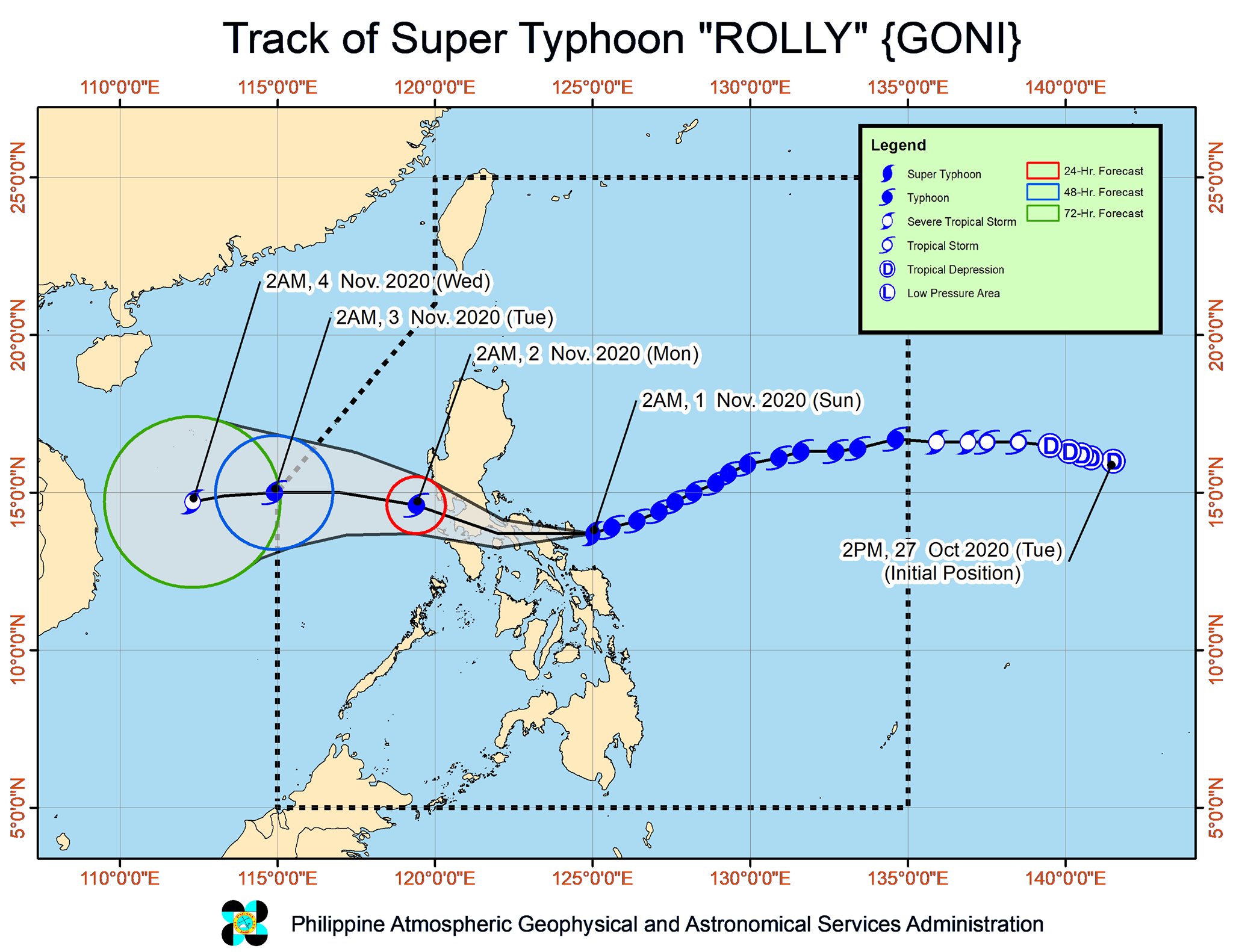
As of this writing super-typhoon Goni (codenamed “Rolly” in the Philippines) hit land in Bato, Catanduanes in the Philippines’ east coast. The storm is packing winds of 225 kph accompanied by 280 kph gusts. It is moving southwest at 25 kph in the direction of Mindoro island.
According to projections issued by the Philippine Atmospheric, Geophysical and Astronomical Services Administration (PAGASA), the storm may change course midway and follow a northwestern pathway through Metro Manila, the Philippines’ most populous metropolis.
| SUPPORT INDEPENDENT SOCIAL COMMENTARY! Subscribe to our Substack community GRP Insider to receive by email our in-depth free weekly newsletter. Subscribe to our Substack newsletter, GRP Insider! Learn more |
Discover Magazine reports, “After landfall early on Sunday local time, the rugged terrain in the storm’s path should sap its strength. Even so, it will still ‘bring very destructive typhoon-force winds,’ according to PAGASA. Torrential rainfall, flooding and flash flooding, and landslides are also expected.”
For now, PAGASA is monitoring river basins in Cagayan and the Bicol region reporting that Naga City is at risk of possible flooding as well as areas with poor drainage systems.
- How the political camps that presume to represent “civil society” might learn from the debacle the Ateneo finds itself in today - June 21, 2026
- WHO instructed Tab Baldwin to “limit” his public “apology” to just “four minutes”? - June 14, 2026
- The public relations debacle the Ateneo finds itself in following the tragic deaths of Rene Clert Baterbonia and Divine Adili - June 11, 2026
I wonder what will happen to the Manila Bay White Sand Beach when that supertyphoon Rolly gonna hit it here in Luzon & Metro Manila is now under signal #4? And then the mainstream media & Yellowtards would like to see that beach into smithereens & its been “washed-out” rather than “washed-in” by the strong waves brought about by the supertyphoon Rolly. OK Boomers, you have you’re day. ?
We pray that the Typhoon did not have much destruction…